Garden Point Boat-in Campground
Camptonville, California · USDA Forest Service
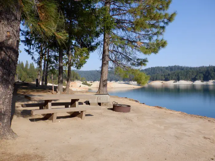
Photo: Recreation.gov
About
Bullards Bar Reservoir is located on the North Yuba River at an elevation of 2000 feet. It is located approximately 21 miles north of Nevada City, California. It has a maximum surface area of 4,760 acres and a length of over 16 miles and shoreline of more than 60 miles. This is a boat-in campground. You can not drive to this campground. You must launch a boat a Dark Day boat launch and boat to the campground. The sides of the reservoir are generally steep and public access for boating and recreation is limited. The reservoir is surrounded by both conifer and hardwood forests with numerous brush species. There is plenty of shade at the campsites There is a beautiful non- motorized trail system in the area, with 5 different trails to choose from. Bullards Bar Trailhead is 14 miles, 7 Ball Trial is 1 mile, 8 Ball Trail is 3.8 miles, Rebel Ridge Trail is 1.6 miles and Schoolhouse Trail is 0.7 miles. Maps are available at the North Yuba Ranger Station just a couple miles east of the reservoir on Marysville Road. This is a boat-in campground. You can not drive to this campground. You must launch a boat a Dark Day boat launch and boat to the campground. Activities include wildlife viewing, hiking, mountain biking, horseback riding, camping, fishing, boating, water skiing, and other water sports. Swimming opportunities are limited because of the steep slopes; however boaters will find numerous opportunities for swimming in various locations around the reservoir. The reservoir provides yearlong fishing opportunities for both warm and cold water fish species. Supplies are available at the marina as well as the nearby communities of Camptonville, North San Juan, and Dobbins. This location is unstaffed. To speak with our main office for general information, please call: (530) 265-4531.This is a boat-in campground. You can not drive to this campground. You must launch a boat a Dark Day boat launch and boat to the campground. Public access for boating and recreation is limited to 2 developed and 1 undeveloped boat launches: the Cottage Creek Boat Launch ramp at Emerald Cove Marina (aprox. 3 miles from campground by boat), the Dark Day Boat Launch ramp (aprox. 1 mile from campground by boat), and the undeveloped site at the end of Moran Road. The area includes 5 campgrounds, 2 picnic areas, 2 boat launch ramps, 1 marina, 1 overlook, 1 day use area and several developed hiking trails.
Directions
This is a boat-in campground. You can not drive to this campground. You must launch a boat a Dark Day boat launch and boat to the campground. From Nevada City, California, travel approximatley 20 miles north on Highway 49 to Marysville Road. Turn left onto Marysville Road and travel approximatley 3 miles to the Dark Day Boat Launch ramp and launch from the ramp. Or travel approximatley 7 miles to Emerald Cove Marina and launch from the launch and ramp there.
Location
Map tiles © OpenStreetMap.
Details
- State
- California
- City / area
- Camptonville
- Agency
- USDA Forest Service
- Parent area
- Tahoe National Forest
- Campsites
- 16
- Reservable
- Yes
- Typical price
- $24–$48 / night
- Rating
- 3.67 / 5 (27 reviews on Recreation.gov)
- Equipment
- Boat
Nearby campgrounds
- Dark Day Campground 1.5 km away · dump mentioned
- Schoolhouse Campground (CA) 1.7 km away · dump mentioned
- Hornswoggle Group Campground 2.0 km away
- Cottage Creek Campground (CA) 4.5 km away · dump mentioned
- Madrone Cove Boat-in Campground 5.3 km away
- CARLTON 14.3 km away