Reading Island Group Campground
Cottonwood, California · Bureau of Land Management
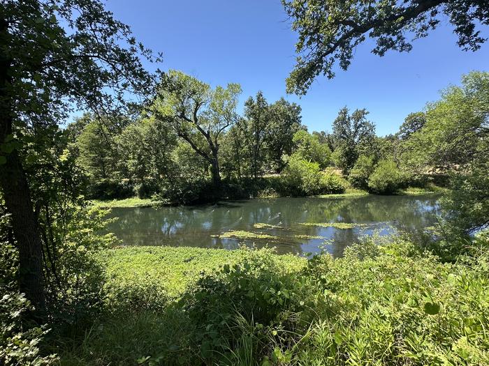
Photo: Recreation.gov
About
Reading Island Group Campground is located on the beautiful Sacramento River in Shasta County, California. The campground has one group site that can accommodate up to 20 campers, has one vault toilet, fire rings, and picnic tables. There is easy access to the Sacramento River with informal access areas along the shore and a concrete boat ramp where campers can enjoy swimming, paddling, and fishing during the non-summer months. The boat ramp is inaccessible during the summer months due to aquatic plants. The campground is nearby to many other recreational experiences in Tehama and Shasta Counties such as - trails, wildflowers, wildlife, multi-day floats, more.The Reading Island Group Campground contains fire rings, picnic tables, and a vault toilet. The area is generally flat with room for 20 campers. There is ample vehicle and RV parking at the group area, but no hook-ups for water, electricity, or sewer. Adjacent to the area is a boat ramp into Anderson Creek Slough that flows into the Sacramento River. This ramp is ideal for canoes, kayaks, and rafts; however, the slough can be difficult to navigate with motorboats during the summer months when plant life becomes thick on the surface of the slough. The boat ramp may be entirely clogged with plants during summer months making in inaccessible by any craft. The downstream tip of the island offers a fair landing site, but is ½ mile from the parking area. There are short dirt trails around the island to explore on foot.Reading Island is a lush riparian island located between the Sacramento River and Anderson Creek Slough. The surrounding area is made up of the rolling hills of blue oak savanna with a diverse habitat for bald eagles, osprey, migratory and song birds, deer, and salmon.Sacramento River Bend Recreation Area has a diverse network of river access, trails, and parking areas. Horseback riding, hunting, target shooting, birding, and wildflower viewing are all very popular in the area. More information and a map can be found on the BLM website . Redding offers hundreds of non-motorized multi-use trails including paved paths and singletrack dirt, many optimized for downhill mountain biking. Find out more on the Visit Redding website . Whiskeytown National Recreation Area: Fishing, boating, swimming, and hiking. More information on the Park Service website . Cottonwood and Anderson, CA: Small towns with dining and shopping options. Redding, CA: Large town with an airport, hospitals, dining and shopping
Directions
From Interstate Highway 5 take exit 664 onto 4th St heading east for approximately 1 mile. Turn left on Balls Ferry Rd and travel approximately 2 miles. Turn right onto Adobe Rd and follow it until it ends and you encounter the yellow BLM gate.
Location
Map tiles © OpenStreetMap.
Details
- State
- California
- City / area
- Cottonwood
- Agency
- Bureau of Land Management
- Parent area
- Sacramento River Bend Area
- Campsites
- 1
- Reservable
- Yes
- Typical price
- $90 / night
- Equipment
- Tent, RV, Caravan/Camper Van, Pickup Camper, Fifth Wheel, Pop up
Nearby campgrounds
- SYCAMORE GROVE (RED BLUFF) CAMPGROUND 25.6 km away · dump mentioned
- Camp Discovery Group Camp (Red Bluff Recreation Area) 25.7 km away · dump mentioned
- HORSE CAMP PRIMITIVE CAMPGROUND 35.2 km away
- PELTIER BRIDGE PRIMITIVE CAMPGROUND 37.3 km away
- Lower Jones Valley (CA) 38.1 km away
- Jones Valley Inlet West Dispersed Area (CA) 38.2 km away