West Point Campground
Pollock, California · USDA Forest Service
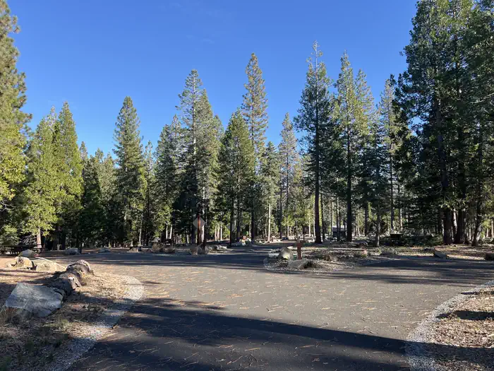
Photo: Recreation.gov
About
West Point Campground is located on the northwest shore of Union Valley reservoir off of North Union Valley Road. There are 22 sites ranging from sinlge to triple in capacity. There is a boat ramp with access to the reservior. The campground and boat ramp are at 4,875 feet in elevation. Boating Fishing Biking Swimming Hiking For facility specific information, please call (831) 245-6891. 22 sites Boat ramp Day use area The Desolation Wilderness is nearby offering overnight pack trips or day hikes to see the beauty of the Seirras.
Directions
Access is via Highway 50, 23 miles east of Placerville, California, then 7 miles north on Ice House Road, turn left onto Peavine Ridge Road for 3 miles, make a right turn on Bryant Springs Road, go 5 miles north across the dam and just past the boat ramp to the right
Location
Map tiles © OpenStreetMap.
Details
- State
- California
- City / area
- Pollock
- Agency
- USDA Forest Service
- Parent area
- Eldorado National Forest
- Campsites
- 21
- Reservable
- Yes
- Typical price
- $36–$145 / night
- Rating
- 4.42 / 5 (38 reviews on Recreation.gov)
- Equipment
- Tent, RV, Trailer
Nearby campgrounds
- SUNSET-UNION VALLEY 3.2 km away · dump mentioned
- FASHODA 3.8 km away · dump mentioned
- WOLF CREEK CALIFORNIA 3.9 km away
- YELLOWJACKET 4.9 km away · dump mentioned
- WENCH CREEK 6.0 km away
- SILVER CREEK GROUP CAMPGROUND 6.6 km away · dump mentioned