Deerhorn Campground
Bates, Oregon · USDA Forest Service
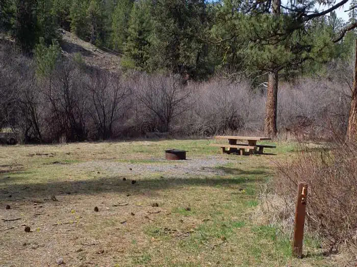
Photo: Recreation.gov
About
This small campground offers fishing, exploring, nature watching and hunting opportunities in the Middle Fork John Day River State Scenic Waterway. The campground is busiest during late summer and hunting season. For facility specific information, please call (541) 575-3000.Each campsite has a picnic table, fire ring, and parking for camp trailers. Accessible vault toilet is conveniently located in the campground.Borders Middle Fork John Day RiverDavis Creek Trail Vinegar Hill Indian Rock Scenic Area Tempest Mine Trail Sunrise Butte Trail Princess Trail Bates State Park Austin HouseVisitors can enjoy abundant recreation, from fishing the Middle Fork John Day River to exploring the surrounding forested landscape. This area also provides convenient access to hunting terrain.
Directions
From Prairie City, OR., travel east on Highway 26 approximately 13 miles to the junction of Highway 26 and Highway 7. Turn onto Highway 7 for approximately 1/8th of a mile to the junction with County Road 20, turn onto County Road 20. On County Road 20 travel approximately 4 miles, the campground will be on your left. The turn for the campground is on a corner, the entrance is marked with a small green sign.
Location
Map tiles © OpenStreetMap.
Details
- State
- Oregon
- City / area
- Bates
- Agency
- USDA Forest Service
- Parent area
- Malheur National Forest
- Campsites
- 5
- Reservable
- Yes
- Typical price
- $8 / night
- Equipment
- Tent, RV, Trailer, Caravan/Camper Van, Pickup Camper, Fifth Wheel, Pop up, Hammock
Nearby campgrounds
- Middle Fork Campground 2.2 km away
- Dixie Campground 9.3 km away
- SUNSHINE GUARD STATION 10.6 km away
- Olive Lake Campground (OR) 18.0 km away
- Lower Camp Creek Campground 18.2 km away
- Hilltop Hideaway - Umatilla NF (OR) 20.4 km away