Idlewild Campground
Burns, Oregon · USDA Forest Service
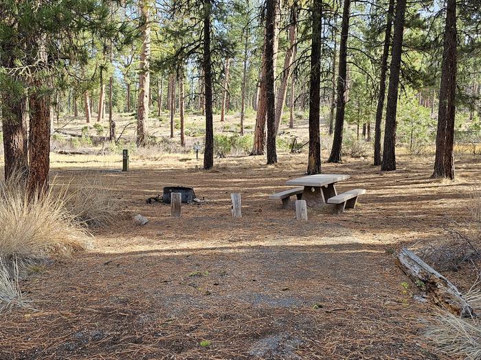
Photo: Recreation.gov
About
Constructed by the Civilian Conservation Corps in the 1930's, Idlewild Campground is an easily accessible campground located just off of US Highway 395. The campground is lightly used and only becomes busy during the fall hunting season. Please pack out what you pack in, there is no trash service provided at this campground. The campground is a great place for those traveling through who would like a nice quiet place to camp that is easy to reach.For local information, please call (541) 573-4300 or call (541) 575-3000 for general information.reservable group picnic shelter located within Idlewild CampgroundIdlewild Loop Trail Idlewild Sno-Park Joaquin Miller Horse Camp Joaquin Miller Horse Trail King Mountain Lookout Poison Creek Reservoir Burns BLM
Directions
Directions from Burns, OR., travel 2.8 miles on US Highway 20 to the junction with US Highway 395, turn left onto US Highway 395 and head north. Follow US Highway 395 for approximately 14.6 miles to the junction with Forest Road 2820. Continue on Forest Road 2820 for 0.8 miles to the junction with Idlewild Campground Road. Follow Idlewild Road for approximately 1 mile to the campground.
Location
Map tiles © OpenStreetMap.
Details
- State
- Oregon
- City / area
- Burns
- Agency
- USDA Forest Service
- Parent area
- Malheur National Forest
- Campsites
- 26
- Reservable
- Yes
- Typical price
- $10 / night
- Rating
- 4.50 / 5 (2 reviews on Recreation.gov)
- Equipment
- Tent, RV, Trailer, Caravan/Camper Van, Pickup Camper, Fifth Wheel, Pop up
Nearby campgrounds
- IDLEWILD 0.1 km away
- Joaquin Miller Horse Camp 3.3 km away
- Rock Springs Campground 25.5 km away
- Falls Campground (Malheur National Forest) 34.2 km away
- Parish Cabin Campground 45.9 km away
- Wickiup Campground 47.6 km away