Esterbrook Campground
Douglas, Wyoming · USDA Forest Service
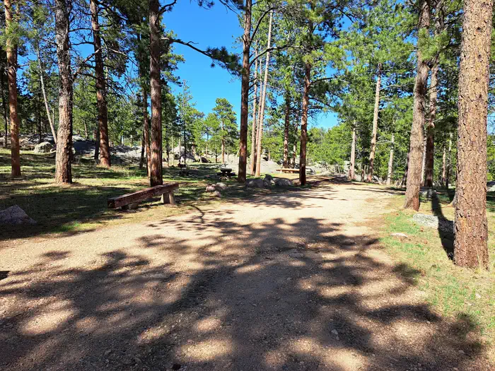
Photo: Recreation.gov
About
Esterbrook Campground is nestled within a pine forest along a broad ridge north of Laramie Peak. A favorite of both RV and tent campers, it is a terrific jumping-off point for recreating in the Laramie Peak Unit of the Douglas Ranger District. The campground is popular for OHV riding, fishing, hiking, hunting, and mountain biking.There are 12 campsites in a lightly wooded, rocky area with picnic tables, fire rings, pedestal grills, vault toilets, trash collection, and potable water. Most campsites have a dispersed feel as they are widely spaced apart. Potable water is typically available in this campground from mid-May to late November. These dates may vary due to weather. Potable water availability may vary due to well and/or pump maintenance, and water testing requirements. As such, we encourage you to bring your own potable water or call ahead. Located at an elevation of 6,300 feet, the campground sits in an open forest of ponderosa pine. The Laramie Peak Unit of the Medicine Bow-Routt National Forests and Thunder Basin National Grassland encompass approximately 352,000 acres of the Laramie Range in central Wyoming. Mule deer, elk, black bear, whitetail deer, antelope, bald eagles, gos hawks, bobcat, coyote, big horned sheep, yellow-bellied marmots, and mountain lions are just some of the many animals that inhabit the diverse lands on Laramie Peak. Visitors can find many outdoor opportunities in the surrounding area including OHV riding, hiking, backpacking, mountain biking, hunting, fishing, sightseeing, photography, and horseback riding. Fishing opportunities nearby at Lower Horseshoe Creek. Sunday services available nearby at the historic Esterbrook Community Church (non-denominational). Recreation The Laramie Peak area in the Medicine Bow National Forest is located in Central Wyoming. The Douglas Ranger District manages the Laramie Peak and Thunder basin National Grasslands areas. Year-round recreation uses include hiking, fishing, hunting, OHV riding, camping, biking and horseback trail riding. Primary access across the district is by I-25 and Highway 59. Mountain Biking • Upper Roaring Fork Trail • Friend Park Trail • North Laramie River Trail • Harris Park Trail • Laramie Peak Trail • Sunset Ridge Trail • Lost Creek Trail • Albany Peak Trails • Black Mountain Look out Mountain Climbing • Curtis Gulch Trail Day Hiking • Upper Roaring Fork Trail • Friend Park Trail • North Laramie River Trail • Harris Park Trail • Laramie Peak Trail • Sunset Ridge
Directions
Campground is approximately 3 miles east of Esterbrook, WY on Forest Service Road 633. From I25 North Douglas, WY (30 miles) - take Highway 94 which turns into County Road 5 (Esterbrook Road) south for 27 miles, then 3 miles east on Forest Road 633. From I25 South - Take Glendo exit and go west on CR6 for 20 miles to CR5, then south 2 miles to Esterbrook. Go east 3 miles on FS 633 to the campground. The roads are well signed and easily accessible to automobiles of all types.
Location
Map tiles © OpenStreetMap.
Details
- State
- Wyoming
- City / area
- Douglas
- Agency
- USDA Forest Service
- Parent area
- Medicine Bow-Routt NFs & Thunder Basin NG
- Campsites
- 12
- Reservable
- Yes
- Typical price
- $20–$65 / night
- Rating
- 4.40 / 5 (15 reviews on Recreation.gov)
- Equipment
- Tent, RV, Trailer, Caravan/Camper Van, Pickup Camper, Fifth Wheel, Pop up, Boat, Hammock
Nearby campgrounds
- Friend Park Campground 22.8 km away
- Curtis Gulch Campground 24.8 km away
- LA PRELE GUARD STATION 42.2 km away
- Campbell Creek Campground 42.4 km away
- Rim Campground 82.0 km away
- Lodgepole Campground 82.2 km away